Planning Policy at Southend Borough CouncilPlanning Policy System
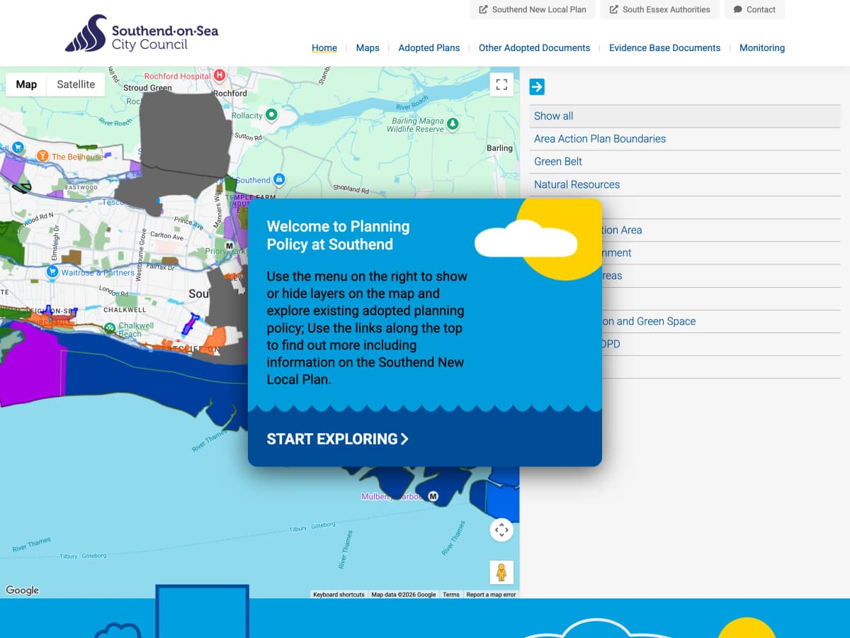
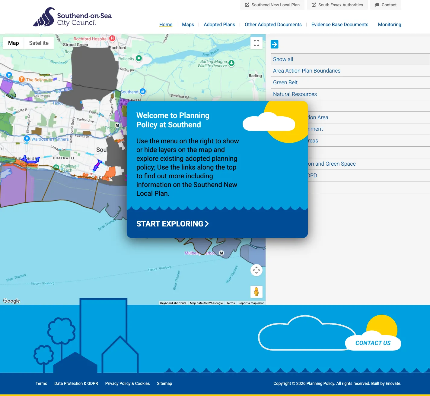
A map-based web application for Southend-on-Sea Borough Council using Google Maps to display proposed planning changes for the borough of Southend-on-Sea.
- Platform
- Craft CMS
- Location
- Southend-on-Sea, UK
- Client since
- 2019
The final product
Screenshots showcasing the responsive design across devices.
The Brief
To help inform the citizens of Southend-on-Sea regarding the proposed planning policy changes the Borough Council needed a new website that was easy to use and allowed visitors to explore and understand a wealth of complex map-based data.
The new site also had to be easy for staff at the Council to update and maintain on a day-to-day basis so it needed a great content management system behind the scenes, a perfect fit for Craft CMS.
The most challenging aspect of the project was the need to translate exported mapping data from the Council’s internal GIS system into a format that could be imported into Google Maps and presented as individual layers that could be enabled and disabled at will.
What we did
We began by designing and developing a framework site for the content and map-based data to be presented in. This had to be relatively fuss-free to ensure ample space was given to the various map-based pages as well as being responsive so it continued to function reliably on any device.
With the framework in place our focus switched to setting up the content pages - a simple task with a content management system like Craft - and then integrating the map data. The various layers of data had to be colour coded and developed in such a way that they could be enabled and disabled so that a visitor can isolate a single layer or see how multiple layers (effectively changes to planing) might affect one-another.
The converting of mapping file formats and integration into Google Maps did throw up several challenges but these were overcome and the resulting site has been a great success for Southend-on-Sea Borough Council and we continue to work with them to develop and enhance the site.

Key features
The components and capabilities we delivered.
Google Maps Integration
Custom Google Maps implementation displaying planning policy data as colour-coded, toggleable layers imported from the Council's GIS system.
Interactive Data Layers
Visitors can enable and disable individual planning layers to isolate changes or see how multiple proposals might interact.
Craft CMS Content Pages
Easy-to-maintain content pages managed through Craft CMS, giving Council staff full control over supporting information.
Our approach
A proven process tailored to this project's unique requirements.
Discovery
We start by understanding your goals, audience, and constraints. Through workshops and research, we define the project scope and success criteria.
Strategy & wireframing
We map out the user journey and information architecture. Low-fidelity wireframes let us test ideas quickly before committing to design.
UX/UI design
Visual design that balances aesthetics with usability. We create interfaces that look great and guide users effortlessly toward their goals.
Development
Clean, well-documented code built on proven frameworks. We develop iteratively, sharing progress regularly so you're never in the dark.
Quality assurance & launch
Applications and integration-heavy builds ship with automated test suites, and every project is checked across devices and browsers before it goes live. We handle deployment and keep the launch itself uneventful.
Ongoing support
Our relationship doesn't end at launch. We provide proactive maintenance, security updates, and responsive support to keep your product thriving.
related projects



Planning a similar project?
Let's discuss how we can help you achieve your digital goals. We typically respond within one business day.